2014
NS9535 : Maurice's Cleuch, Tinto
taken 10 years ago, 4 km SW of Thankerton, South Lanarkshire, Scotland
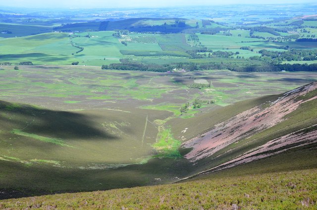
Maurice's Cleuch, Tinto
A steep-sided valley on the N side of the hill. The more distant ridge partly under cloud shadows is Carmichael Hill.
 Map © Crown Copyright")
TIP: Click the map for more Large scale mapping
- Grid Square
- NS9535, 58 images (more nearby 🔍)
- Photographer
- Jim Barton (more nearby)
- Date Taken
- Wednesday, 11 June, 2014 (more nearby)
- Submitted
- Thursday, 12 June, 2014
- Subject Location
-
OSGB36:
 NS 9521 3563 [10m precision]
WGS84: 55:36.1778N 3:39.8867W - Camera Location
-
OSGB36: NS 9550 3514
- View Direction
- North-northwest (about 337 degrees)