2014
ST0380 : Pontyclun Football Club clubhouse, Ivor Park
taken 10 years ago, near to Brynsadler, Rhondda Cynon Taf, Wales
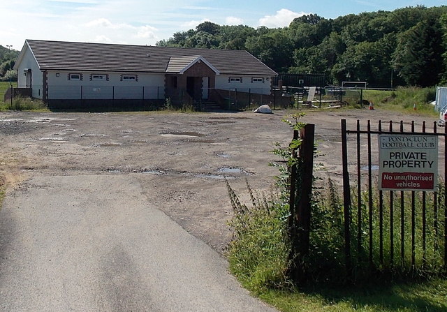
Pontyclun Football Club clubhouse, Ivor Park
Viewed from the Cowbridge Road entrance to Ivor Park, the home ground of Pontyclun Football Club.
 Map © Crown Copyright")
TIP: Click the map for more Large scale mapping
- Grid Square
- ST0380, 27 images (more nearby 🔍)
- Photographer
- Jaggery (more nearby)
- Date Taken
- Thursday, 12 June, 2014 (more nearby)
- Submitted
- Thursday, 12 June, 2014
- Subject Location
-
OSGB36:
 ST 0316 8092 [10m precision]
WGS84: 51:31.1322N 3:23.8255W - Camera Location
-
OSGB36: ST 0312 8095
- View Direction
- Southeast (about 135 degrees)