2014
SD7273 : Rantry Hole at foot of grassy slope
taken 10 years ago, 3 km from Ingleton, North Yorkshire, England
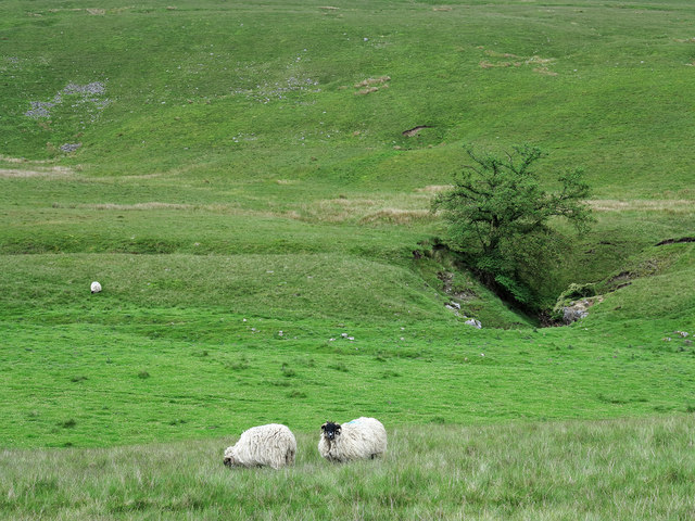
Rantry Hole at foot of grassy slope
Rantry Hole lies to the south of the footpath near to the farm at Crina Bottom, en route between Ingleton and Ingleborough; it's described as a shake hole on OS maps but could be something other.
 Map © Crown Copyright")
TIP: Click the map for more Large scale mapping
- Grid Square
- SD7273, 57 images (more nearby 🔍)
- Photographer
- Trevor Littlewood (more nearby)
- Date Taken
- Saturday, 14 June, 2014 (more nearby)
- Submitted
- Tuesday, 17 June, 2014
- Subject Location
-
OSGB36:
 SD 7225 7335 [10m precision]
WGS84: 54:9.3126N 2:25.5847W - Camera Location
-
OSGB36: SD 7218 7343
- View Direction
- Southeast (about 135 degrees)