2014
TQ0411 : Path into a dry valley
taken 10 years ago, near to Amberley, West Sussex, England
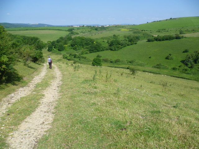
Path into a dry valley
This delightful path leads down into a classic dry valley on the chalk, and then up the other side to meet the South Downs Way. Despite its proximity to the South Downs Way the valley cannot be seen from it and it therefore seems quiet and remote. Downs Farm can be seen in the distance on the other side of the valley.
 Map © Crown Copyright")
TIP: Click the map for more Large scale mapping
- Grid Square
- TQ0411, 71 images (more nearby 🔍)
- Photographer
- Marathon (more nearby)
- Date Taken
- Saturday, 21 June, 2014 (more nearby)
- Submitted
- Sunday, 22 June, 2014
- Subject Location
-
OSGB36:
 TQ 0429 1152 [10m precision]
WGS84: 50:53.6254N 0:31.1105W - Camera Location
-
OSGB36: TQ 0436 1146
- View Direction
- Northwest (about 315 degrees)