2014
SZ0891 : Bournemouth: some large-scale development activity
taken 10 years ago, near to Westbourne, Bournemouth, Christchurch & Poole, England
This is 1 of 689 images, with title starting with Bournemouth in this square
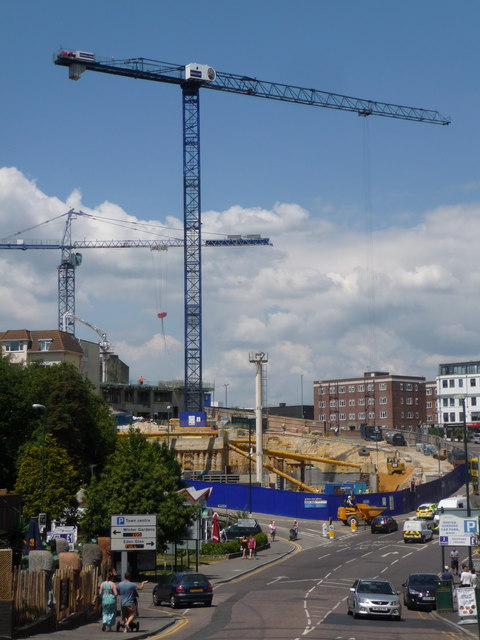
Bournemouth: some large-scale development activity
Until a couple of months ago it was a large, derelict lump of land at a much higher level - see the foot of the crane and the course of Terrace Road running alongside - along with a public car park at that higher level.
The development is set to be a Hilton Hotel with a panoramic restaurant on the top (nineteenth) floor, along with the associated car parking and I believe 60 residential apartments. It is expected to be completed in 2016.
Large supports hold the surrounding ground in place while the early excavation work (groundwork, one might say) continues on the site.
 Map © Crown Copyright")
TIP: Click the map for more Large scale mapping
- Grid Square
- SZ0891, 1884 images (more nearby 🔍)
- Photographer
- Chris Downer (more nearby)
- Date Taken
- Monday, 23 June, 2014 (more nearby)
- Submitted
- Monday, 23 June, 2014
- Subject Location
-
OSGB36:
 SZ 0851 9102 [10m precision]
WGS84: 50:43.1248N 1:52.8491W - Camera Location
-
OSGB36: SZ 0860 9093
- View Direction
- Northwest (about 315 degrees)