2014
D1201 : The Ballymena bypass - July 2014(4)
taken 10 years ago, near to Ballymena, Co Antrim, Northern Ireland
The Ballymena bypass - July 2014(4)
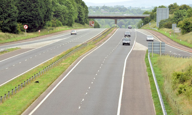
The completed road, looking towards Ballymoney and Coleraine, from the northern side of the roundabout. For comparison then and now see D1201 : M2, Ballymena - the missing link (June 2006).
M2 Ballymena bypass, Larne Road roundabout
When the M2 Ballymena bypass opened in 1969 the intention was to connect it to the Belfast-Antrim section. In the event the plan was abandoned and a dual carriageway was (eventually) built instead over most of the route. That still left a gap at the southern end which remained for some 40 years. Work started in June 2009 on the missing link and was completed in August 2010.
Loading map... (JavaScript required)
- Grid Square
- D1201, 28 images (more nearby 🔍)
- Photographer
- Albert Bridge (more nearby)
- Date Taken
- Thursday, 3 July, 2014 (more nearby)
- Submitted
- Thursday, 3 July, 2014
- Subject Location
-
Irish:
 D 123 019 [100m precision]
WGS84: 54:51.1612N 6:15.0523W - Camera Location
-
Irish: D 123 018
- View Direction
- NORTH (about 0 degrees)