TR1134 : Old and new castle
taken 10 years ago, near to West Hythe, Kent, England
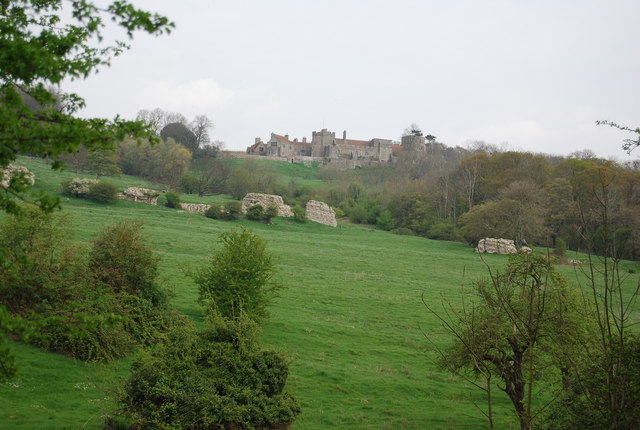
Portus Lemanis was the Latin name of an ancient Roman fort, settlement and port in southern Kent. The modern village of Lympne derives its name from the ancient port.
The fort stood on a hill overlooking a reach of sea which has since been drained to form the Romney Marsh.
The construction of the Saxon Shore-era fort can be dated to the late 270s, as is evidenced by its late-style characteristics, including forward-projecting towers.The remains are in poor condition, since the ground, mostly clay, has at places given way. The southern side of the fort is wholly missing, and elsewhere the remains have been moved at various angles, while little evidence of interior structures (remains of a bath and possibly the principia) survives.
In the United Kingdom, a scheduled monument is a 'nationally important' archaeological site or historic building, given protection against unauthorised change.
There are about 20,000 scheduled monuments in England representing about 37,000 heritage assets. Of the tens of thousands of scheduled monuments in the UK, most are inconspicuous archaeological sites, but some are large ruins.
Wikipedia: Link
 Map © Crown Copyright")
- Grid Square
- TR1134, 161 images (more nearby 🔍)
- Photographer
- N Chadwick (more nearby)
- Date Taken
- Saturday, 12 April, 2014 (more nearby)
- Submitted
- Monday, 7 July, 2014
- Subject Location
-
OSGB36:
 TR 1174 3429 [10m precision]
WGS84: 51:4.1322N 1:1.2510E - Camera Location
-
OSGB36: TR 1161 3405
- View Direction
- North-northeast (about 22 degrees)