2014
NS2374 : Former Greenock High School building
taken 10 years ago, near to Braeside, Inverclyde, Scotland
This is 1 of 15 images, with title Former Greenock High School building in this square
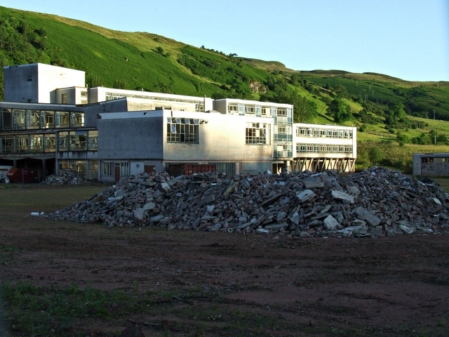
Former Greenock High School building
The rubble on the football field is from the demolished Glenburn School which was out of shot on the left.
Greenock High School, Inverkip Road
The Inverkip Road building opened in 1971, replacing the previous building which was located on Dunlop Street.
The buildings were demolished, along with the adjacent Glenburn special needs school in 2013-14. The site was cleared and a new access bridge built over the Spango Burn in preparation for the construction of a new female only prison, but the prison project was cancelled due to a change in strategy by the Scottish government.
 Map © Crown Copyright")
TIP: Click the map for more Large scale mapping
- Grid Square
- NS2374, 273 images (more nearby 🔍)
- Photographer
- Thomas Nugent (more nearby)
- Date Taken
- Sunday, 29 June, 2014 (more nearby)
- Submitted
- Wednesday, 9 July, 2014
- Subject Location
-
OSGB36:
 NS 2396 7489 [10m precision]
WGS84: 55:56.0844N 4:49.1867W - Camera Location
-
OSGB36: NS 2398 7499
- View Direction
- South-southwest (about 202 degrees)