2014
SK5744 : Valley Road Park Flood Plain, Nottingham NG5
taken 10 years ago, 3 km from Arnold, Nottinghamshire, England
This is 1 of 2 images, with title Valley Road Park Flood Plain, Nottingham NG5 in this square
Valley Road Park Flood Plain, Nottingham NG5
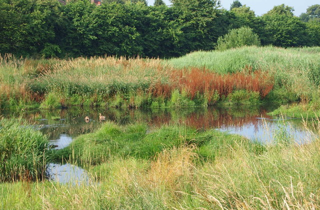
This long, thin, sausage-shaped park is known as Day Brook Recreation Ground at its other end. Here, at its Mansfield Road end it is called Valley Road Park. Nonetheless the footpath, seen here passing the Day Brook flood plain (or flood fringe), is actually an almost continuous path between the Valley Rd/Mansfield Rd junction entrance and its Edwards Lane exit. Valley Road (the A6514) runs behind the tree line directly ahead.
 Map © Crown Copyright")
TIP: Click the map for more Large scale mapping
- Grid Square
- SK5744, 112 images (more nearby 🔍)
- Photographer
- David Hallam-Jones (more nearby)
- Date Taken
- Saturday, 12 July, 2014 (more nearby)
- Submitted
- Saturday, 12 July, 2014
- Subject Location
-
OSGB36:
 SK 5757 4423 [10m precision]
WGS84: 52:59.5390N 1:8.6266W - Camera Location
-
OSGB36: SK 5757 4423
- View Direction
- Southeast (about 135 degrees)