2014
TL4855 : Towards Addenbrooke's from Limekiln Hill
taken 10 years ago, near to Cherry Hinton, Cambridgeshire, England
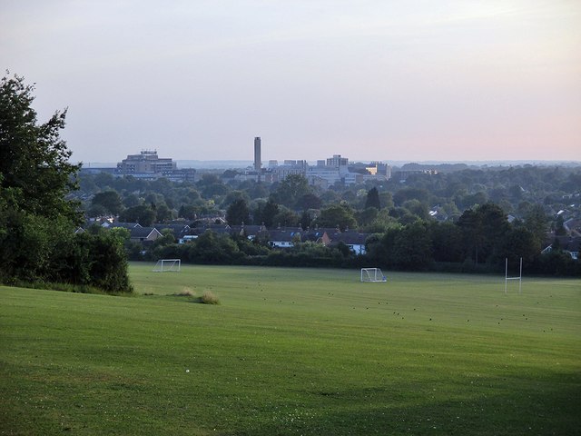
Towards Addenbrooke's from Limekiln Hill
A summer-evening view of Netherhall School playing fields and the leafy southern edge of the city. The nearest houses are on Beaumont Road and Addenbrooke's Hospital is on the skyline. TL4855 : Netherhall School Playing Field is a comparable view, taken in October 2010.
 Map © Crown Copyright")
TIP: Click the map for more Large scale mapping
- Grid Square
- TL4855, 95 images (more nearby 🔍)
- Photographer
- John Sutton (more nearby)
- Date Taken
- Friday, 18 July, 2014 (more nearby)
- Submitted
- Friday, 18 July, 2014
- Subject Location
-
OSGB36:
 TL 480 554 [100m precision]
WGS84: 52:10.6416N 0:9.8097E - Camera Location
-
OSGB36: TL 482 555
- View Direction
- West-southwest (about 247 degrees)