2014
TG1721 : Pillbox north of Heath Road
taken 10 years ago, near to The Heath, Norfolk, England
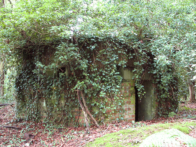
Pillbox north of Heath Road
This is a type-22 pillbox which is believed to have formed part of RAF Swannington defences. For another view of this pillbox see > Link and for an interior view see > Link.
RAF Swannington
The aerodrome at Swannington became operational in April 1944. It was the last airfield to be opened in Norfolk during the war. Locally known as Haveringland airfield, the station was the home of two RAF squadrons, the 85th and the 157th, and for some time also of No. 229 and 451 Squadrons of the Royal Australian Air Force. Put under RAF care and maintenance in August 1945 it was closed in 1947 and sold off in 1957. See also: Link
 Map © Crown Copyright")
TIP: Click the map for more Large scale mapping
- Grid Square
- TG1721, 24 images (more nearby 🔍)
- Photographer
- Evelyn Simak (more nearby)
- Date Taken
- Monday, 21 July, 2014 (more nearby)
- Submitted
- Monday, 21 July, 2014
- Subject Location
-
OSGB36:
 TG 1703 2133 [10m precision]
WGS84: 52:44.7596N 1:12.8403E - Camera Location
-
OSGB36: TG 1705 2134
- View Direction
- West-southwest (about 247 degrees)