TQ3403 : Undercliff Walk by Brighton Marina
taken 10 years ago, near to Ovingdean, Brighton And Hove, England
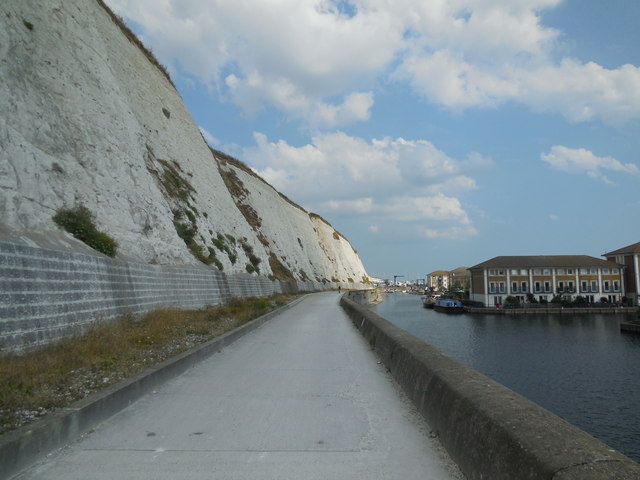
Brighton Marina is a large, man-made marina. The construction of the marina itself took place between 1971 and 1979, although developments within it have continued ever since. The marina covers an area of approximately 127 acres.
Link
In 1928, Rottingdean parish was absorbed by Brighton and in order to protect the coastline an impressive sea wall at the base of the cliffs was erected, initially from Black Rock (the former boundary of Brighton parish) to Rottingdean.
The Undercliff Walk, as it became known, was designed by borough engineer David Edwards and opened in July 1933. It was extended to Saltdean Gap in July 1935 when the Rottingdean swimming-pool was built to replace bathing facilities lost to the wall.
A final short addition to the wall taking it to the very end of the borough boundary was made later in 1935. The Undercliff Walk is now 3.35 miles long and forms part of a 7.5 mile promenade from Portslade to Saltdean. Link
 Map © Crown Copyright")
- Grid Square
- TQ3403, 177 images (more nearby 🔍)
- Photographer
- Paul Gillett (more nearby)
- Date Taken
- Wednesday, 23 July, 2014 (more nearby)
- Submitted
- Thursday, 24 July, 2014
- Subject Location
-
OSGB36:
 TQ 3413 0320 [10m precision]
WGS84: 50:48.7697N 0:5.8495W - Camera Location
-
OSGB36: TQ 34071 03227
- View Direction
- East-southeast (about 112 degrees)