2014
NS5477 : Gun emplacement
taken 10 years ago, near to Mugdock, Stirling, Scotland
This is 1 of 4 images, with title Gun emplacement in this square
Gun emplacement
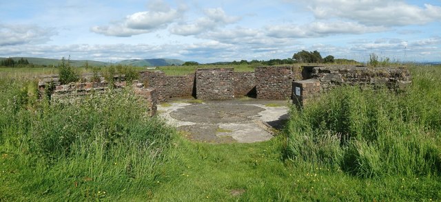
Reckoning from north to south, this is the second of four gun emplacements at the site. On the page whose link is given in the end-note, this is gun emplacement number 1.
AA Battery Mugdock
The remains of a Second World War anti-aircraft battery (consisting of four gun emplacements and a command post) and of the accommodation camp that was associated with it. They were located in what is now Mugdock Country Park. See Link
(at SecretScotland) for further details.
 Map © Crown Copyright")
TIP: Click the map for more Large scale mapping
- Grid Square
- NS5477, 185 images (more nearby 🔍)
- Photographer
- Lairich Rig (more nearby)
- Date Taken
- Friday, 20 June, 2014 (more nearby)
- Submitted
- Monday, 28 July, 2014
- Subject Location
-
OSGB36:
 NS 5437 7726 [10m precision]
WGS84: 55:57.9716N 4:20.0839W - Camera Location
-
OSGB36: NS 5437 7726
- View Direction
- EAST (about 90 degrees)