2014
SJ3092 : Liscard former Drill Hall and house (3)
taken 10 years ago, near to Wallasey, Wirral, England
This is 1 of 3 images, with title starting with Liscard former Drill Hall and house in this square
Liscard former Drill Hall and house (3)
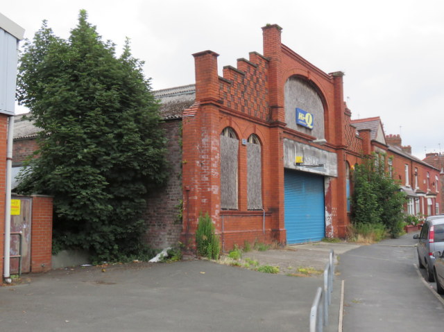
Looking along the curved Urmson Road towards the west side and front of the former drill hall. See also: SJ3092 : Liscard former Drill Hall and house and SJ3092 : Liscard former Drill Hall and house (2)
Liscard Drill Hall
The building is first recorded on the 1911 O.S. map where the former Townfield Lane has been renamed Urmson Road. In more recent years the building was used as a tyre fitting garage, but now it is boarded up, has holes in the windows, and appears to be disused, which is a pity for such a finely designed frontage.
 Map © Crown Copyright")
TIP: Click the map for more Large scale mapping
- Grid Square
- SJ3092, 34 images (more nearby 🔍)
- Photographer
- John S Turner (more nearby)
- Date Taken
- Tuesday, 29 July, 2014 (more nearby)
- Submitted
- Wednesday, 30 July, 2014
- Subject Location
-
OSGB36:
 SJ 3083 9228 [10m precision]
WGS84: 53:25.3656N 3:2.5403W - Camera Location
-
OSGB36: SJ 3082 9227
- View Direction
- Northeast (about 45 degrees)