2014
TF8506 : The Norden bombsight building
taken 10 years ago, near to North Pickenham, Norfolk, England
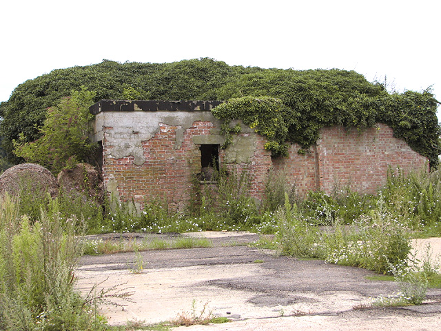
The Norden bombsight building
It is situated on the former Administrative/HQ site of RAF North Pickenham. The Operations block and a couple of sheds have survived here, albeit neglected and much overgrown. Concrete platforms mark the locations of some other buildings that once stood here.
Named after engineer Carl L Norden, who designed and developed the apparatus for US Naval aircraft, the Norden bombsight was one of the most important US military secrets of WW2, and crew members had to take an oath to protect its secrecy with their lives. It was a mechanical analog computer used for determining the exact moment bombs had to be dropped to accurately hit the target, and when properly aimed it could place a bomb inside a 31.4 metres (100 foot) circle from four miles 6,436 meters (4 miles) high.
Named after engineer Carl L Norden, who designed and developed the apparatus for US Naval aircraft, the Norden bombsight was one of the most important US military secrets of WW2, and crew members had to take an oath to protect its secrecy with their lives. It was a mechanical analog computer used for determining the exact moment bombs had to be dropped to accurately hit the target, and when properly aimed it could place a bomb inside a 31.4 metres (100 foot) circle from four miles 6,436 meters (4 miles) high.
RAF North Pickenham (USAAF Station 143)
The aerodrome at North Pickenham was constructed in 1943/44 for the use of the United States Army Air Forces (USAAF) Eighth Air Force and designated USAAF Station 143. The first group to move onto the airfield was the 492nd Bombardment Group (Heavy), flying Liberator bomber aircraft. Due to heavy losses the group was transferred in August 1944, and the 491st BG replaced it.
After the war, the airfield was returned to the RAF and it was closed in 1949. In December 1958 however, the station was transferred from Home Command to Bomber Command in preparation for its used as a Thor missile site. After the missile site was dismantled in 1963 the field was closed for good and finally sold off in 1967. See also: Link
 Map © Crown Copyright")
TIP: Click the map for more Large scale mapping
- Grid Square
- TF8506, 24 images (more nearby 🔍)
- Photographer
- Evelyn Simak (more nearby)
- Date Taken
- Saturday, 2 August, 2014 (more nearby)
- Submitted
- Saturday, 2 August, 2014
- Subject Location
-
OSGB36:
 TF 8550 0602 [10m precision]
WGS84: 52:37.2151N 0:44.3328E - Camera Location
-
OSGB36: TF 8552 0602
- View Direction
- West-northwest (about 292 degrees)