2007
SO9988 : Titford Canal at Langley
taken 17 years ago, near to Oldbury, Sandwell, England
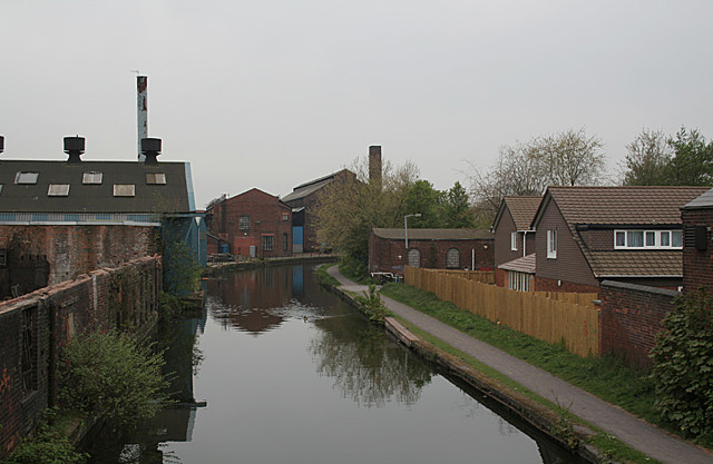
Titford Canal at Langley
This view shows some typical smaller metal-based industry which was so characteristic of the Black Country. Such views become harder to find every year as these industries go out of business or relocate. The modern housing is becoming a much more typical canalside scene.
The Titford Canal is the highest point of the Birmingham Canal Navigations, and the second highest navigable waterway in the UK.
The Titford Canal is the highest point of the Birmingham Canal Navigations, and the second highest navigable waterway in the UK.
 Map © Crown Copyright")
TIP: Click the map for more Large scale mapping
- Grid Square
- SO9988, 95 images (more nearby 🔍)
- Photographer
- Alan Murray-Rust (more nearby)
- Date Taken
- Sunday, 22 April, 2007 (more nearby)
- Submitted
- Monday, 23 April, 2007
- Subject Location
-
OSGB36:
 SO 994 880 [100m precision]
WGS84: 52:29.4218N 2:0.6071W - Camera Location
-
OSGB36: SO 994 881
- View Direction
- South-southwest (about 202 degrees)