2007
SH7153 : A depleted waterfall on the upper reaches of Afon Ystumiau
taken 17 years ago, near to Dolwyddelan, Conwy, Wales
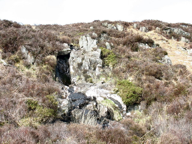
A depleted waterfall on the upper reaches of Afon Ystumiau
 Map © Crown Copyright")
TIP: Click the map for more Large scale mapping
- Grid Square
- SH7153, 17 images (more nearby 🔍)
- Photographer
- Eric Jones (more nearby)
- Date Taken
- Saturday, 21 April, 2007 (more nearby)
- Submitted
- Tuesday, 24 April, 2007
- Subject Location
-
OSGB36:
 SH 713 538 [100m precision]
WGS84: 53:3.9703N 3:55.2943W - Camera Location
-
OSGB36: SH 713 538
- View Direction
- EAST (about 90 degrees)