2014
SK9871 : Narrowboat on the Witham Navigation
taken 10 years ago, near to Lincoln, Lincolnshire, England
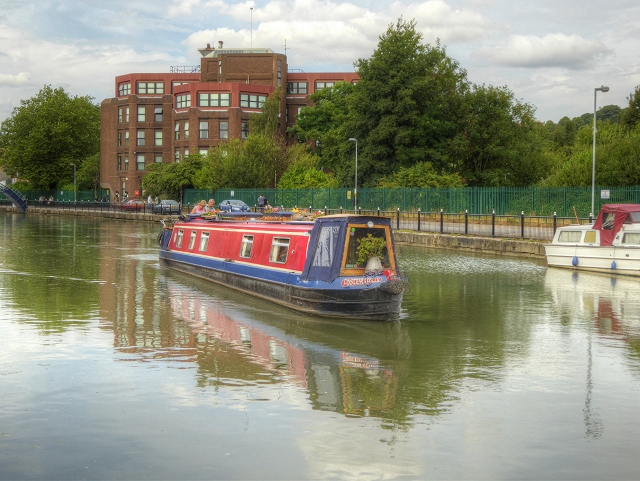
Narrowboat on the Witham Navigation
Narrowboat "Foster's Folly" on the Witham Navigation, just to the east of Lincoln city centre. The River Witham (Witham Navigation) is navigable for 36 miles from Lincoln, High Bridge (the Glory Hole), where it joins the Fossdyke Canal, to the mouth of the river at Hobhole Drain.
River Witham
The River Witham is a 82 mile long river, almost entirely in Lincolnshire. It rises south of Grantham close to South Witham, passes Lincoln and Boston, finally flowing into The Haven, a tidal arm of The Wash. The river is navigable from Lincoln to Boston.
Wikipedia: Link
 Map © Crown Copyright")
TIP: Click the map for more Large scale mapping
- Grid Square
- SK9871, 451 images (more nearby 🔍)
- Photographer
- David Dixon (more nearby)
- Date Taken
- Tuesday, 5 August, 2014 (more nearby)
- Submitted
- Monday, 11 August, 2014
- Subject Location
-
OSGB36:
 SK 9814 7112 [10m precision]
WGS84: 53:13.6839N 0:31.8798W - Camera Location
-
OSGB36: SK 9819 7109
- View Direction
- West-northwest (about 292 degrees)