2014
TA1431 : Storm damage on Staveley Road, Hull
taken 10 years ago, near to Sutton-on-Hull, Kingston Upon Hull, England
This is 1 of 6 images, with title Storm damage on Staveley Road, Hull in this square
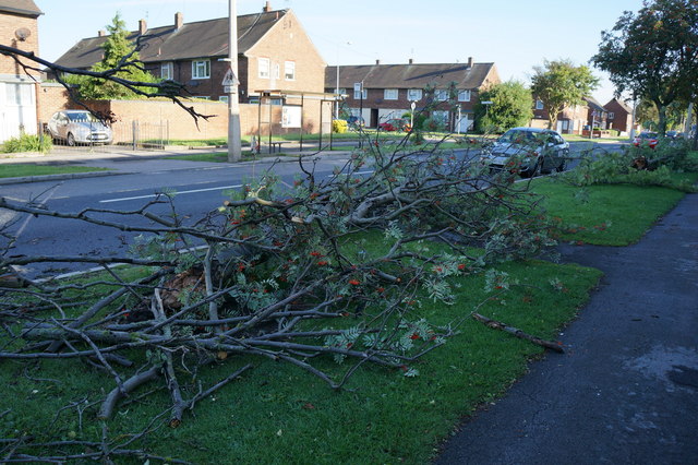
Storm damage on Staveley Road, Hull
On the 10th of August 2014 a Funnel Cloud struck this area of Hull. The Funnel Cloud was the result of the tail end of Hurricane Bertha that made her way across the Atlantic from America.
See other images of Hull, 10-8-2014, storm damage
See other images of Hull, 10-8-2014, storm damage
 Map © Crown Copyright")
TIP: Click the map for more Large scale mapping
- Grid Square
- TA1431, 346 images (more nearby 🔍)
- Photographer
- Ian S (more nearby)
- Date Taken
- Monday, 11 August, 2014 (more nearby)
- Submitted
- Monday, 11 August, 2014
- Subject Location
-
OSGB36:
 TA 1407 3127 [10m precision]
WGS84: 53:45.9179N 0:16.2577W - Camera Location
-
OSGB36: TA 1408 3126
- View Direction
- North-northwest (about 337 degrees)