2005
TQ3508 : Falmer Pond and St Laurence Church
taken 19 years ago, near to Falmer, East Sussex, England
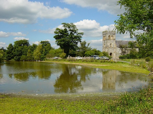
Falmer Pond and St Laurence Church
Looking north. The village of Falmer is recorded in the Domesday Book as 'Falemere'. It is likely that this refers to a lake or pond belonging to Fala. The church is Norman.
 Map © Crown Copyright")
TIP: Click the map for more Large scale mapping
- Grid Square
- TQ3508, 180 images (more nearby 🔍)
- Photographer
- Janine Forbes (more nearby)
- Date Taken
- Sunday, 21 August, 2005 (more nearby)
- Submitted
- Monday, 22 August, 2005
- Subject Location
-
OSGB36:
 TQ 354 087 [100m precision]
WGS84: 50:51.7178N 0:4.6467W