2014
NO7095 : East end of 'The Platties'
taken 10 years ago, near to Banchory, Aberdeenshire, Scotland
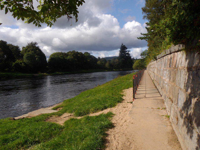
East end of 'The Platties'
An elevated paved/railed walkway along the bank of the River Dee in east Banchory.
 Map © Crown Copyright")
TIP: Click the map for more Large scale mapping
- Grid Square
- NO7095, 170 images (more nearby 🔍)
- Photographer
- Stanley Howe (more nearby)
- Date Taken
- Saturday, 23 August, 2014 (more nearby)
- Submitted
- Saturday, 23 August, 2014
- Subject Location
-
OSGB36:
 NO 7090 9575 [10m precision]
WGS84: 57:3.1134N 2:28.8789W - Camera Location
-
OSGB36: NO 7093 9576
- View Direction
- West-southwest (about 247 degrees)