2014
NS9368 : Site of Drill Hall, Armadale
taken 10 years ago, near to Armadale, West Lothian, Scotland
Site of Drill Hall, Armadale
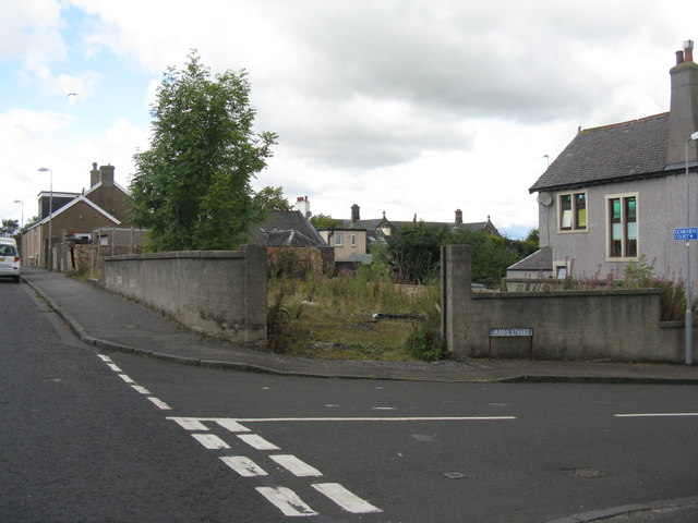
On James Street, Armadale, this was the site of a WW1 drill hall of the 10th (Cyclist) Battalion, Royal Scots (C Company) Link. It was later used as a Catholic chapel, and then as a builder's yard but burnt down in a fire that necessitated evacuation of houses on James Street and High Academy Street. It was demolished about 5 years ago. I was told that the shooting range had lead-lined walls to absorb bullets, and the value of lead recovered at demolition covered the cost of the site purchase.
 Map © Crown Copyright")
TIP: Click the map for more Large scale mapping
- Grid Square
- NS9368, 31 images (more nearby 🔍)
- Photographer
- M J Richardson (more nearby)
- Date Taken
- Saturday, 23 August, 2014 (more nearby)
- Submitted
- Saturday, 23 August, 2014
- Subject Location
-
OSGB36:
 NS 9364 6838 [10m precision]
WGS84: 55:53.8052N 3:42.1471W - Camera Location
-
OSGB36: NS 9368 6837
- View Direction
- WEST (about 270 degrees)