2014
NT7123 : Blakeman's Crag
taken 10 years ago, near to Cessford, Scottish Borders, Scotland
This is 1 of 4 images, with title Blakeman's Crag in this square
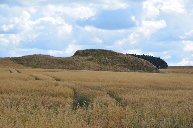
Blakeman's Crag
An outcrop in the farmland on Cessford Moor, close to the route of St Cuthbert's Way.
 Map © Crown Copyright")
TIP: Click the map for more Large scale mapping
- Grid Square
- NT7123, 23 images (more nearby 🔍)
- Photographer
- Jim Barton (more nearby)
- Date Taken
- Thursday, 7 August, 2014 (more nearby)
- Submitted
- Friday, 29 August, 2014
- Subject Location
-
OSGB36:
 NT 7174 2332 [10m precision]
WGS84: 55:30.1700N 2:26.9362W - Camera Location
-
OSGB36: NT 7145 2355
- View Direction
- Southeast (about 135 degrees)