2014
TQ2580 : Kensington Palace Vicinity, London
taken 10 years ago, near to Kensington, Kensington And Chelsea, England
Kensington Palace Vicinity, London
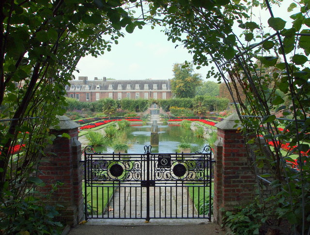
The Dutch sunken garden in Kensington Palace gardens is seen here from one of the gates allowing access to approved persons only from Cradle Walk (a.k.a. The Bowery). Cradle Walk is an arched arbour of red-twigged lime. These shaded cloisters and the gardens were laid out in 1908, or perhaps more accurately they were re-established for Edward VII, re-creating the formal gardens that existed at Kensington Palace in the C17th. Kensington Gardens were once part of Hyde Park until William IV enclosed the area as the gardens for Kensington Palace.
 Map © Crown Copyright")
TIP: Click the map for more Large scale mapping
- Grid Square
- TQ2580, 739 images (more nearby 🔍)
- Photographer
- David Hallam-Jones (more nearby)
- Date Taken
- Thursday, 4 September, 2014 (more nearby)
- Submitted
- Friday, 5 September, 2014
- Subject Location
-
OSGB36:
 TQ 2594 8008 [10m precision]
WGS84: 51:30.3377N 0:11.2074W - Camera Location
-
OSGB36: TQ 2595 8009
- View Direction
- West-southwest (about 247 degrees)