SJ9398 : Entering Portland Basin
taken 10 years ago, near to Ashton-Under-Lyne, Tameside, England
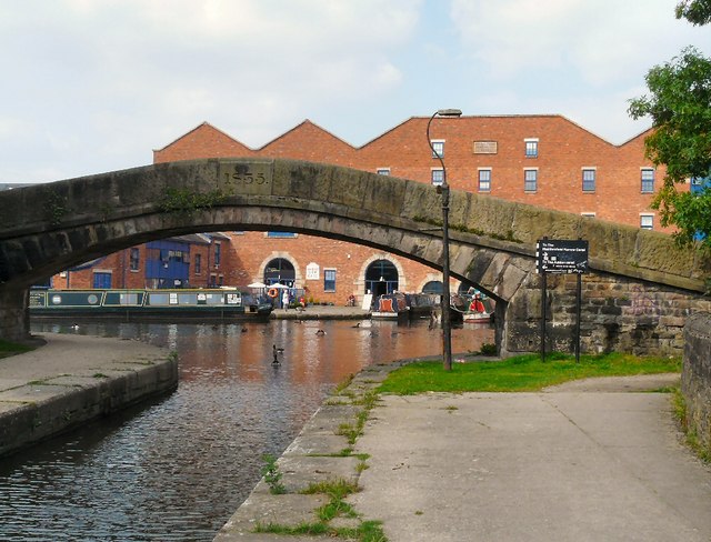
The Peak Forest Canal runs for 15 miles between Ashton under Lyne and Whaley Bridge.
It was built to link the Ashton Canal with the tramways that brought limestone from the Peak District quarries.
The Lower Peak Forest Canal forms part of the "Cheshire Ring".
LinkPennine Waterways website including a "virtual tour" of the canal
Link
The Ashton Canal runs eastwards from Manchester to Ashton under Lyne. It links the Huddersfield Narrow Canal and Peak Forest Canal with the Rochdale Canal and Bridgewater Canal and forms part of the "Cheshire Ring".
The original scheme was completed in 1796, running from a large basin behind what is now Piccadilly Station in Manchester, climbing gradually eastwards via 18 locks to Fairfield, Droylsden. From there one level section continued eastward to Whitelands Basin, Ashton under Lyne, while another arm headed north through what is now Daisy Nook, climbing another eight locks to Hollinwood, with a branch running east from Daisy Nook towards Park Bridge. A short arm from Portland Basin crossed the River Tame to Dukinfield. A year later an additional branch from Clayton to Stockport was opened.
The short link between Ashton Canal Basin at Piccadilly and the Rochdale Canal was not opened until 1800, when disputes about canal tolls and responsibility for paving the streets around the basins were resolved.
The Peak Forest Canal, opened in 1800, joined the Ashton Canal by way of the Dukinfield spur across the aqueduct over the Tame at Portland Basin.
The Hollinwood Branch Canal closed in sections between 1932 and 1961. The Stockport Branch Canal was closed in 1962.
History: Link
![Creative Commons Licence [Some Rights Reserved]](https://s1.geograph.org.uk/img/somerights20.gif)


- Grid Square
- SJ9398, 686 images (more nearby 🔍)
- Photographer
- Gerald England (more nearby)
- Date Taken
- Friday, 5 September, 2014 (more nearby)
- Submitted
- Sunday, 7 September, 2014
- Subject Location
-
OSGB36:
 SJ 9348 9841 [10m precision]
WGS84: 53:28.9421N 2:5.9830W - Camera Location
-
OSGB36: SJ 9350 9839
- View Direction
- Northwest (about 315 degrees)


