2014
TQ7178 : The Thames foreshore and seawall above Lower Hope Point
taken 10 years ago, 3 km from Cliffe, Medway, England
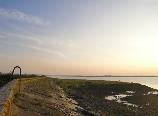
The Thames foreshore and seawall above Lower Hope Point
Behind the camera is the last bend in the river before it reaches the open sea. Going up river, the next bend comes at Coalhouse Point (more than 3km distant,on the Essex shore). This reach of the river is known as the Lower Hope - or in older documents, simply as the Hope. The distant power station is at Tilbury.
Photo taken at about 6.40pm on a September evening.
Photo taken at about 6.40pm on a September evening.
 Map © Crown Copyright")
TIP: Click the map for more Large scale mapping
- Grid Square
- TQ7178, 102 images (more nearby 🔍)
- Photographer
- Stefan Czapski (more nearby)
- Date Taken
- Tuesday, 9 September, 2014 (more nearby)
- Submitted
- Thursday, 11 September, 2014
- Subject Location
-
OSGB36:
 TQ 7113 7826 [10m precision]
WGS84: 51:28.6449N 0:27.7731E - Camera Location
-
OSGB36: TQ 7142 7854
- View Direction
- Southwest (about 225 degrees)