2014
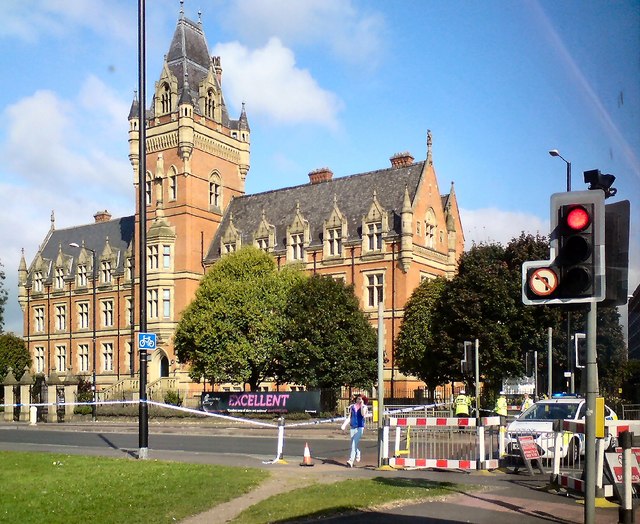
SJ8596 : Hyde Road Closed
taken 12 years ago, near to Manchester, England
This is 1 of 5 images, with title starting with Hyde Road in this square
Hyde Road Closed
Hyde Road was closed between Nicholls Campus and the Apollo due to a "police incident".
Nicholls Hospital was founded by the cotton merchant John Nicholls who died aged only 36 (1823-1859). It was completed in 1881 and served as a school for poor boys of the area. During WWII it was used as a barracks. In 1953 it became Nicholls County Secondary School for Boys and later became part of Ellen Wilkinson High School. Now known as Nicholls Campus, in 2002 it became part of Manchester College.
Nicholls Hospital was founded by the cotton merchant John Nicholls who died aged only 36 (1823-1859). It was completed in 1881 and served as a school for poor boys of the area. During WWII it was used as a barracks. In 1953 it became Nicholls County Secondary School for Boys and later became part of Ellen Wilkinson High School. Now known as Nicholls Campus, in 2002 it became part of Manchester College.


TIP: Click the map for more Large scale mapping
- Grid Square
- SJ8596, 143 images (more nearby 🔍)
- Photographer
- Gerald England (more nearby)
- Date Taken
- Monday, 15 September, 2014 (more nearby)
- Submitted
- Monday, 15 September, 2014
- Subject Location
-
OSGB36:
 SJ 8574 9693
[10m precision]
WGS84: 53:28.1347N 2:12.9769W - Camera Location
-
OSGB36:
SJ 8575 9688
- View Direction
- North-northwest (about 337 degrees)


