2014
SP2484 : Horse pasture near Butlers End
taken 10 years ago, near to Meriden, Solihull, England
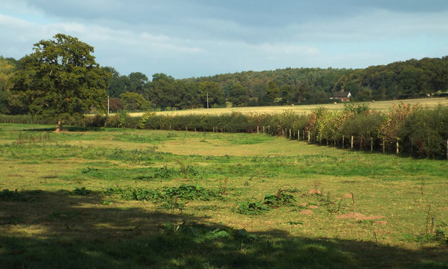
Horse pasture near Butlers End
I thought of titling this 'The path not taken', echoing Robert Frost's 'The Road not Taken' but without the allegory. I misread the map, misread the ground and missed a missing field boundary. I struggled over barbed wire-topped fences and a stream, twice, to get further along the field when I could have simply walked along by this hedge (and said hello to the horses). It was a fine warm September afternoon.
The wooded rising ground in the distance is Close Wood, believed to be part of the Packington estate.
The wooded rising ground in the distance is Close Wood, believed to be part of the Packington estate.
 Map © Crown Copyright")
TIP: Click the map for more Large scale mapping
- Grid Square
- SP2484, 9 images (more nearby 🔍)
- Photographer
- Robin Stott (more nearby)
- Date Taken
- Sunday, 21 September, 2014 (more nearby)
- Submitted
- Monday, 22 September, 2014
- Subject Location
-
OSGB36:
 SP 2432 8411 [10m precision]
WGS84: 52:27.2644N 1:38.6127W - Camera Location
-
OSGB36: SP 2423 8404
- View Direction
- Northeast (about 45 degrees)