2014
TQ4840 : The Sussex Border Path heads towards the Uckfield Line
taken 10 years ago, near to Blackham, East Sussex, England
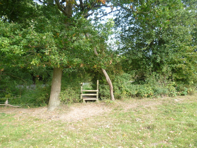
The Sussex Border Path heads towards the Uckfield Line
Kent Water, which is a tributary of the River Medway, forms the county boundary here and the Sussex Border Path follows this side of the river which is in East Sussex. A small stream passes under the footbridge ahead and reaches the Kent Water a little way to the left. Beyond the wire fence which can be seen in the distance is the Uckfield Line between Cowden and Ashurst.
 Map © Crown Copyright")
TIP: Click the map for more Large scale mapping
- Grid Square
- TQ4840, 81 images (more nearby 🔍)
- Photographer
- Marathon (more nearby)
- Date Taken
- Saturday, 20 September, 2014 (more nearby)
- Submitted
- Wednesday, 24 September, 2014
- Subject Location
-
OSGB36:
 TQ 4891 4074 [10m precision]
WGS84: 51:8.7936N 0:7.6512E - Camera Location
-
OSGB36: TQ 4889 4074
- View Direction
- EAST (about 90 degrees)