2014
SX4859 : A corner of the wall and ditch of Crownhill Fort
taken 10 years ago, near to Crownhill, Plymouth, England
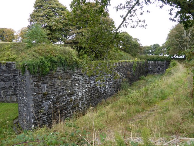
A corner of the wall and ditch of Crownhill Fort
One of the Palmerston Forts (later nicknamed Palmerston Follies) built to protect Plymouth naval dockyard from Napoleon III's potential invasion. The defeat of the French in the Franco-Prussian war made the threat unlikely. Crownhill Fort has been restored by the Landmark Trust
 Map © Crown Copyright")
TIP: Click the map for more Large scale mapping
- Grid Square
- SX4859, 76 images (more nearby 🔍)
- Photographer
- David Smith (more nearby)
- Date Taken
- Friday, 26 September, 2014 (more nearby)
- Submitted
- Friday, 26 September, 2014
- Subject Location
-
OSGB36:
 SX 4882 5913 [10m precision]
WGS84: 50:24.7521N 4:7.7473W - Camera Location
-
OSGB36: SX 4880 5910
- View Direction
- North-northeast (about 22 degrees)