2014
TG1435 : WW2 building on Site 3
taken 10 years ago, near to Plumstead, Norfolk, England
This is 1 of 3 images, with title WW2 building on Site 3 in this square
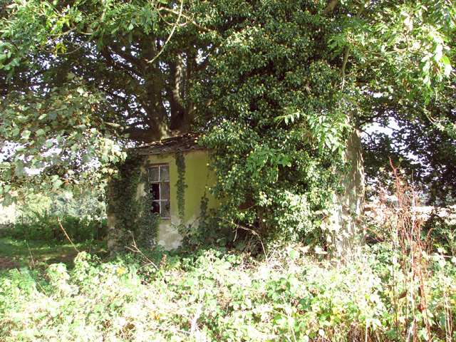
WW2 building on Site 3
Site 3 was one of the accommodation sites of RAF Matlask which was an active airfield during WW2. The structure seen here would seem to have been the entrance porch to an accommodation hut.
RAF Matlask
RAF Matlask became operational in October 1940, serving as a satellite station to RAF Coltishall. The airfield had two grass runways of 1,450 metres (1,600 yards) and 1,190 metres (1,300 yards) length respectively. The station was a place of constant change and home to a large number of units flying a wide range of aircraft, and about 2,500 RAF personnel were stationed here. The aerodrome was closed in October 1945. See also: Link
 Map © Crown Copyright")
TIP: Click the map for more Large scale mapping
- Grid Square
- TG1435, 53 images (more nearby 🔍)
- Photographer
- Evelyn Simak (more nearby)
- Date Taken
- Friday, 3 October, 2014 (more nearby)
- Submitted
- Saturday, 4 October, 2014
- Subject Location
-
OSGB36:
 TG 1403 3520 [10m precision]
WGS84: 52:52.3008N 1:10.7225E - Camera Location
-
OSGB36: TG 1405 3518
- View Direction
- Northwest (about 315 degrees)