2014
TM4766 : Enigmatic beach structure, Minsmere Sluice
taken 10 years ago, 3 km from Eastbridge, Suffolk, England
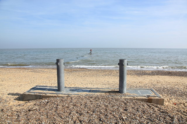
Enigmatic beach structure, Minsmere Sluice
This structure is something to do with the Minsmere Sluice outflow pipe, which the warning marker post beyond sits atop.
 Map © Crown Copyright")
TIP: Click the map for more Large scale mapping
- Grid Square
- TM4766, 88 images (more nearby 🔍)
- Photographer
- Rob Noble (more nearby)
- Date Taken
- Sunday, 28 September, 2014 (more nearby)
- Submitted
- Monday, 6 October, 2014
- Subject Location
-
OSGB36:
 TM 4784 6611 [10m precision]
WGS84: 52:14.2405N 1:37.7083E - Camera Location
-
OSGB36: TM 47816 66122
- View Direction
- East-southeast (about 112 degrees)