1989
TQ4500 : Newhaven Harbour, 1989
taken 35 years ago, near to Newhaven, East Sussex, England
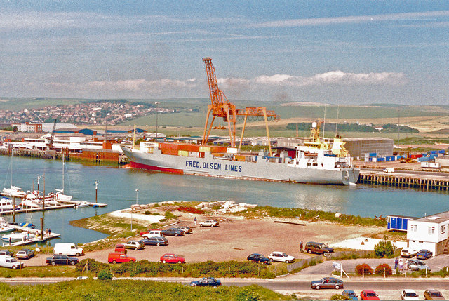
Newhaven Harbour, 1989
View NE from Newhaven Fort, over the quays and up the River Ouse to the South Downs: the view fits precisely to the right of TQ4400 : Newhaven: marina on River Ouse, 1989.
 Map © Crown Copyright")
TIP: Click the map for more Large scale mapping
- Grid Square
- TQ4500, 256 images (more nearby 🔍)
- Photographer
- Ben Brooksbank (more nearby)
- Date Taken
- Sunday, 11 June, 1989 (more nearby)
- Submitted
- Monday, 6 October, 2014
- Subject Location
-
OSGB36:
 TQ 4503 0054 [10m precision]
WGS84: 50:47.1780N 0:3.3645E - Camera Location
-
OSGB36: TQ 4481 0035
- View Direction
- Northeast (about 45 degrees)