2014
SU8987 : Bourne End Railway Bridge
taken 10 years ago, near to Bourne End, Buckinghamshire, England
This is 1 of 8 images, with title Bourne End Railway Bridge in this square
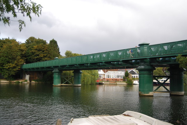
Bourne End Railway Bridge
Bourne End Railway Bridge is a bridge carrying the Marlow Branch Line, and a footpath over the River Thames in Bourne End, Buckinghamshire. It crosses the Thames on the reach between Cookham Lock and Marlow Lock.
The bridge was originally constructed in wood by Isambard Kingdom Brunel as part of the Wycombe Railway, opened in 1854 and operated in broad gauge until 1870. The narrow spans were unpopular with river traffic and it was reconstructed in steel in 1895. A footbridge, cantilevered out from the railway bridge was added in 1992, to take the Thames Path across the river.
In 2013, the bridge was restored and repainted in green, and a large number of rivets which had rusted away were replaced.
See other images of Bourne End Railway Bridge
 Map © Crown Copyright")
TIP: Click the map for more Large scale mapping
- Grid Square
- SU8987, 164 images (more nearby 🔍)
- Photographer
- N Chadwick (more nearby)
- Date Taken
- Saturday, 23 August, 2014 (more nearby)
- Submitted
- Sunday, 12 October, 2014
- Subject Location
-
OSGB36:
 SU 8919 8702 [10m precision]
WGS84: 51:34.5001N 0:42.8623W - Camera Location
-
OSGB36: SU 8915 8700
- View Direction
- East-northeast (about 67 degrees)