2014
TQ7150 : Buston Manor Oast
taken 10 years ago, near to Hunton, Kent, England
This is 1 of 5 images, with title Buston Manor Oast in this square
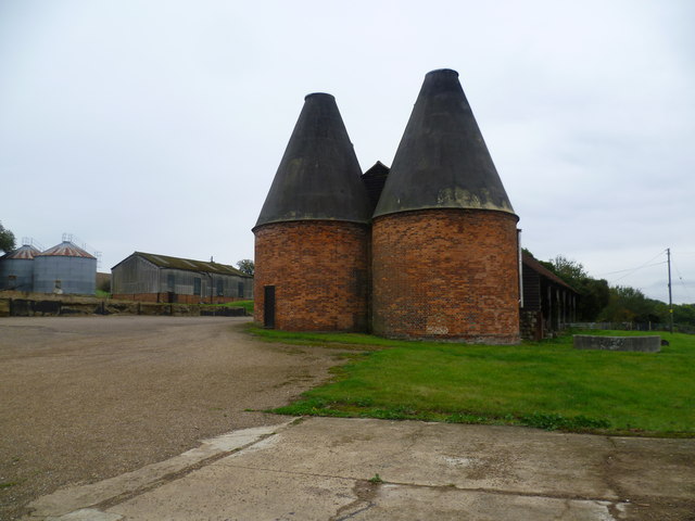
Buston Manor Oast
The Greensand Way is 108 miles long and runs from Haslemere in Surrey to Hamstreet in Kent. This is the section between Yalding and Linton which largely follows the scarp edge of the Greensand Ridge and provides superb views across the Weald.
Here it passes through Buston Manor and its many outbuildings before rising up to the ridge. Buston Manor itself is medieval in origin. For a closer view and a little more detail see Link
The oast houses were noted as being converted for housing in 2008 - see Link and in 2009 - see Link but do not look a whole lot different at the end of 2014.
 Map © Crown Copyright")
TIP: Click the map for more Large scale mapping
- Grid Square
- TQ7150, 45 images (more nearby 🔍)
- Photographer
- Marathon (more nearby)
- Date Taken
- Sunday, 12 October, 2014 (more nearby)
- Submitted
- Tuesday, 14 October, 2014
- Subject Location
-
OSGB36:
 TQ 7145 5084 [10m precision]
WGS84: 51:13.8596N 0:27.2571E - Camera Location
-
OSGB36: TQ 7140 5087
- View Direction
- East-southeast (about 112 degrees)