2014
SE1307 : Dunsley Bank Road
taken 10 years ago, near to Holmfirth, Kirklees, England
This is 1 of 2 images, with title starting with Dunsley Bank in this square
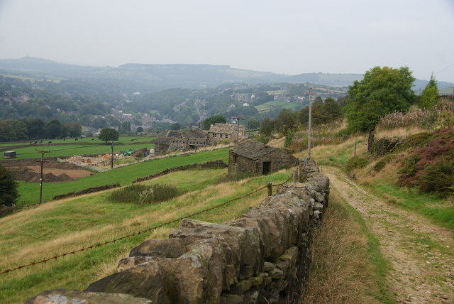
Dunsley Bank Road
A track above the Holme Valley which eventually leads down to Holmfirth.
 Map © Crown Copyright")
TIP: Click the map for more Large scale mapping
- Grid Square
- SE1307, 67 images (more nearby 🔍)
- Photographer
- Bill Boaden (more nearby)
- Date Taken
- Friday, 12 September, 2014 (more nearby)
- Submitted
- Thursday, 16 October, 2014
- Subject Location
-
OSGB36:
 SE 1378 0719 [10m precision]
WGS84: 53:33.6690N 1:47.6062W - Camera Location
-
OSGB36: SE 1375 0716
- View Direction
- Northeast (about 45 degrees)