2014
SK2625 : Claymills level crossing
taken 10 years ago, near to Stretton, Staffordshire, England
This is 1 of 22 images, with title starting with Claymills in this square
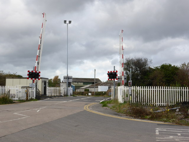
Claymills level crossing
This automatic barrier crossing protects access to the Severn Trent sewage works, Claymills Victorian Pumping Station and several fields. I have frittered away many hours of my life waiting for these barriers to lift. There is a rumour, yet again, that it might be replaced with a bridge. I am sure that those who have been delayed here would welcome that.
 Map © Crown Copyright")
TIP: Click the map for more Large scale mapping
- Grid Square
- SK2625, 585 images (more nearby 🔍)
- Photographer
- Chris Allen (more nearby)
- Date Taken
- Sunday, 19 October, 2014 (more nearby)
- Submitted
- Monday, 20 October, 2014
- Subject Location
-
OSGB36:
 SK 2631 2596 [10m precision]
WGS84: 52:49.8315N 1:36.6564W - Camera Location
-
OSGB36: SK 2632 2596
- View Direction
- WEST (about 270 degrees)