2014
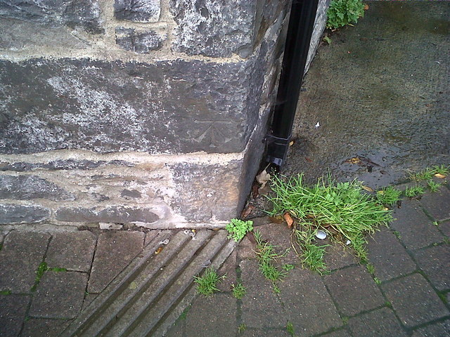
SN6859 : Ordnance Survey Benchmark - Tregaron Square
taken 9 years ago, near to Tregaron, Ceredigion/Sir Ceredigion, Wales
This is 1 of 2 images, with title Ordnance Survey Benchmark - Tregaron Square in this square
Ordnance Survey Benchmark - Tregaron Square
Ordnance Survey Benchmark (OSBM) used for levelling height above Ordnance Datum (OD).
This old cut mark, which was replaced by a new benchmark (NBM) on the adjacent building (~9m W), is still in excellent condition.
Benchmark Height: 540.8 ft. OD (Liverpool)
Close-up: SN6859 : Ordnance Survey Benchmark - Tregaron Square
This old cut mark, which was replaced by a new benchmark (NBM) on the adjacent building (~9m W), is still in excellent condition.
Benchmark Height: 540.8 ft. OD (Liverpool)
Close-up: SN6859 : Ordnance Survey Benchmark - Tregaron Square
 Map © Crown Copyright")
TIP: Click the map for more Large scale mapping
- Grid Square
- SN6859, 74 images (more nearby 🔍)
- Photographer
- N Scott (more nearby)
- Date Taken
- Friday, 24 October, 2014 (more nearby)
- Submitted
- Friday, 24 October, 2014
- Subject Location
-
OSGB36:
 SN 6809 5969 [10m precision]
WGS84: 52:13.1747N 3:55.9431W - Camera Location
-
OSGB36: SN 6809 5969
- View Direction
- NORTH (about 0 degrees)