J3372 : The "Bernard Crossland Building", Belfast - October 2014(2)
taken 9 years ago, near to Belfast, Co Antrim, Northern Ireland
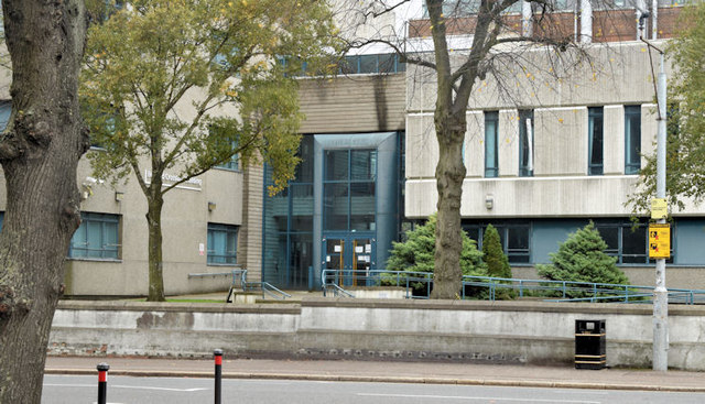
Part of Queens University for which there is the following application for planning permission:
Z/2014/0605/F 25/04/2014 14-18 Malone Road Belfast bt9 5bn [sic] Extension and refurbishment of existing higher level education computer science 'Bernard Crossland Building' (BCB) at 18 Malone Road to provide additional space for computer science education. Removal of 1st floor link from 'BCB' to David Keir Building, new pedestrian access from public footpath and refacing of existing retaining wall along footpath. Refurbishment of 14 and 16 Malone Road, removal of ground floor link to 16 Malone Road, demolition of freestanding wall to rear of 16 Malone Road, new 3 storey glazed link to 16 Malone Road from 'BCB', new ground floor glazed link between rear returns of 14 and 16 Malone Road and associated operational development. This is a link to a Wiki biography of Sir Bernard Link.
The appearance of the building will be completely different after completion of the works.
- Grid Square
- J3372, 1217 images (more nearby 🔍)
- Photographer
- Albert Bridge (more nearby)
- Date Taken
- Sunday, 26 October, 2014 (more nearby)
- Submitted
- Sunday, 26 October, 2014
- Subject Location
-
Irish:
 J 333 723 [100m precision]
WGS84: 54:34.8929N 5:56.2608W - Camera Location
-
Irish: J 333 723
- View Direction
- EAST (about 90 degrees)