2014
SD7816 : Nuttall Lane
taken 10 years ago, near to Ramsbottom, Bury, England
This is 1 of 2 images, with title starting with Nuttall Lane in this square
Nuttall Lane
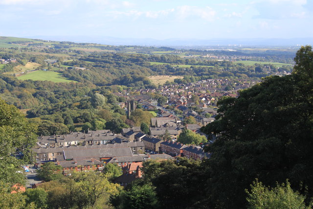
View over Ramsbottom from Holcombe towards St. Andrew's Church, Nuttall Lane and the Irwell Gorge. The area in the photograph shows a moraine left by the last Ice Age where the River Irwell has cut a deep gorge between Ramsbottom and Summerseat.
 Map © Crown Copyright")
TIP: Click the map for more Large scale mapping
- Grid Square
- SD7816, 211 images (more nearby 🔍)
- Photographer
- John Tomlinson (more nearby)
- Date Taken
- Wednesday, 24 September, 2014 (more nearby)
- Submitted
- Sunday, 26 October, 2014
- Subject Location
-
OSGB36:
 SD 7891 1625 [10m precision]
WGS84: 53:38.5399N 2:19.2287W - Camera Location
-
OSGB36: SD 7842 1685
- View Direction
- Southeast (about 135 degrees)