2014
SD7947 : Dockber Laithe
taken 9 years ago, near to Bolton-by-Bowland, Lancashire, England
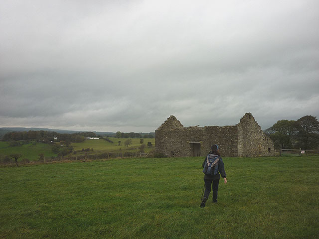
Dockber Laithe
A ruined barn in pastureland above the Ribble. A 'dead end' public footpath descends from here to the banks of the river where the Ribble Way was originally routed.
 Map © Crown Copyright")
TIP: Click the map for more Large scale mapping
- Grid Square
- SD7947, 29 images (more nearby 🔍)
- Photographer
- Karl and Ali (more nearby)
- Date Taken
- Saturday, 25 October, 2014 (more nearby)
- Submitted
- Monday, 27 October, 2014
- Subject Location
-
OSGB36:
 SD 7933 4784 [10m precision]
WGS84: 53:55.5765N 2:18.9753W - Camera Location
-
OSGB36: SD 7933 4781
- View Direction
- NORTH (about 0 degrees)