2014
SK5319 : Browns Lane underpass
taken 10 years ago, near to Loughborough, Leicestershire, England
This is 1 of 12 images, with title Browns Lane underpass in this square
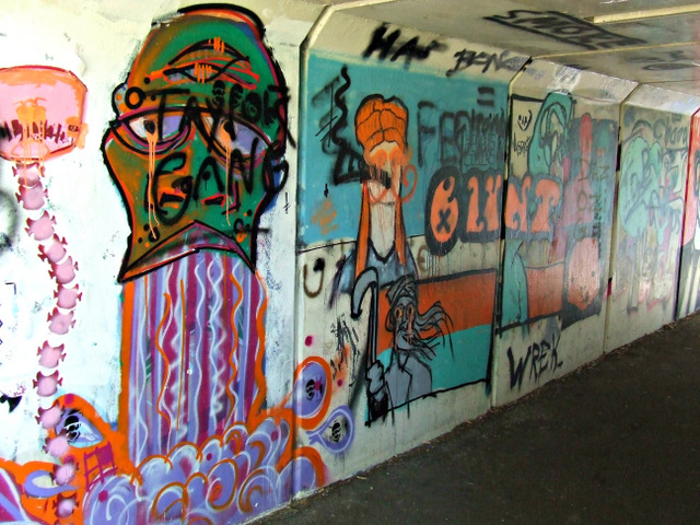
Browns Lane underpass
The underpass connects Queens Park on the north side of Browns Lane and the leisure centre which is on the south side.
Graffiti style artworks sourround the entrances to the underpass and the walls of the underpass itself.
See other images of Browns Lane underpass
Graffiti style artworks sourround the entrances to the underpass and the walls of the underpass itself.
See other images of Browns Lane underpass
 Map © Crown Copyright")
TIP: Click the map for more Large scale mapping
- Grid Square
- SK5319, 577 images (more nearby 🔍)
- Photographer
- Thomas Nugent (more nearby)
- Date Taken
- Monday, 8 September, 2014 (more nearby)
- Submitted
- Sunday, 2 November, 2014
- Subject Location
-
OSGB36:
 SK 5327 1932 [10m precision]
WGS84: 52:46.1314N 1:12.7140W - Camera Location
-
OSGB36: SK 5327 1932