2014
SK9616 : Western Farm
taken 9 years ago, near to Clipsham, Rutland, England
Western Farm
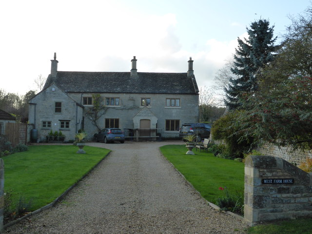
This is a Grade II listed building, where it is known as Western Farm although the nameplate to the right of the entrance now reads West Farm House.
The small 2-storey extension projecting toward the road was built as a post office in the early 19th century.
See the English Heritage listing: Link
The small 2-storey extension projecting toward the road was built as a post office in the early 19th century.
See the English Heritage listing: Link
 Map © Crown Copyright")
TIP: Click the map for more Large scale mapping
- Grid Square
- SK9616, 55 images (more nearby 🔍)
- Photographer
- Bob Harvey (more nearby)
- Date Taken
- Sunday, 9 November, 2014 (more nearby)
- Submitted
- Monday, 10 November, 2014
- Subject Location
-
OSGB36:
 SK 9688 1631 [10m precision]
WGS84: 52:44.1453N 0:33.9956W - Camera Location
-
OSGB36: SK 9692 1631
- View Direction
- WEST (about 270 degrees)