2014
SJ9342 : Uttoxeter Road Approaching Entrance to Meir Tunnel
taken 10 years ago, near to Meir, Stoke-on-Trent, England
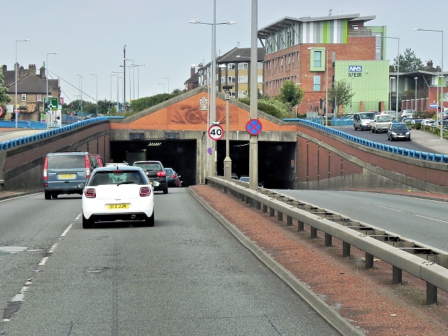
Uttoxeter Road Approaching Entrance to Meir Tunnel
Meir Tunnel, which is 284 metres long, forms part of the upgrading of the A50, through a heavily trafficked urban area of Stoke-on-Trent.
The A50
The A50 is a major trunk road running for almost 100 miles between Warrington and Leicester.
The A50 has been vastly upgraded between Stoke on Trent and J24 of the M1 at Kegworth with much of the route being built in the 1980s and 90s to form a high-speed link across the Midlands, fulfilling a role which was planned to be taken up by the planned M64 motorway which was never built.
 Map © Crown Copyright")
TIP: Click the map for more Large scale mapping
- Grid Square
- SJ9342, 23 images (more nearby 🔍)
- Photographer
- David Dixon (more nearby)
- Date Taken
- Friday, 8 August, 2014 (more nearby)
- Submitted
- Tuesday, 11 November, 2014
- Subject Location
-
OSGB36:
 SJ 9325 4219 [10m precision]
WGS84: 52:58.6209N 2:6.1183W - Camera Location
-
OSGB36: SJ 9330 4216
- View Direction
- West-northwest (about 292 degrees)