TQ6044 : Burgess Hill Farm Oast, Pembury Road, Tonbridge
taken 9 years ago, near to Crockhurst Street, Kent, England
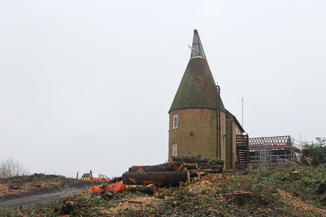
Single round kiln oast house.
Formerly part of May Day Farm.
The building was demolished in April 2015 to make way for the Tonbridge to Pembury A21 road dualling ( Link )
Clearing works began in Autumn 2014 for the long mooted dual carriageway on Pembury road, linking two existing dual carriageways at Tonbridge and Pembury. Construction started 13th April 2015, and was fully opened on 21st September 2017.
The construction works saw a number of houses being demolished, along with Burgess Hill Farm, including an oast house, and a Grade II listed barn and farm house. The barn was taken down to be relocated. A new dual carriageway will be constructed alongside and over the existing carriageway, along with access roads from each side to access Castle Hill Farm, Halfmoon Lane and Pembury Walks, and various houses, with an underpass connecting the two sides.
For more information and map Link

An Oast House is a building used to dry fresh hops before they are sent to the brewers, to be used for flavouring beer. A traditional Oast House consists of the 'oast' and the 'stowage'. The oast was a kiln, with a plenum chamber fired by charcoal at ground floor and the drying floor directly above. The steep pitched roof channelled the hot air through the hops to the top. The stowage, was the barn section, it had a cooling floor and press at first floor and storage area at ground floor. Read more Link
![Creative Commons Licence [Some Rights Reserved]](https://s1.geograph.org.uk/img/somerights20.gif)


- Grid Square
- TQ6044, 85 images (more nearby 🔍)
- Photographer
- Oast House Archive (more nearby)
- Date Taken
- Sunday, 16 November, 2014 (more nearby)
- Submitted
- Sunday, 16 November, 2014
- Subject Location
-
OSGB36:
 TQ 609 440 [100m precision]
WGS84: 51:10.3554N 0:18.0664E - Camera Location
-
OSGB36: TQ 609 440
- View Direction
- East-southeast (about 112 degrees)


