2014
SE0025 : The top end of Hebden Royd FP44
taken 10 years ago, near to Mytholmroyd, Calderdale, England
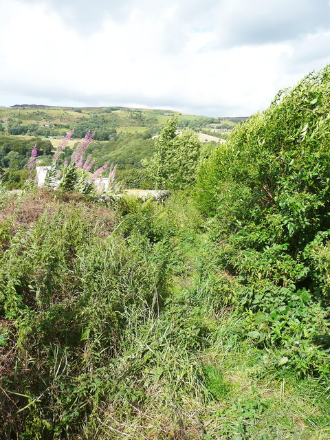
The top end of Hebden Royd FP44
This path tends to get overgrown. It had been cleared (probably by strimming) the next time I looked at it.
 Map © Crown Copyright")
TIP: Click the map for more Large scale mapping
- Grid Square
- SE0025, 262 images (more nearby 🔍)
- Photographer
- Humphrey Bolton (more nearby)
- Date Taken
- Monday, 11 August, 2014 (more nearby)
- Submitted
- Saturday, 29 November, 2014
- Subject Location
-
OSGB36:
 SE 0062 2596 [10m precision]
WGS84: 53:43.8022N 1:59.5249W - Camera Location
-
OSGB36: SE 0062 2596
- View Direction
- Northeast (about 45 degrees)