2014
R0391 : Cliffs of Moher
taken 10 years ago, 4 km NW of Liscannor, Co Clare, Ireland
Cliffs of Moher
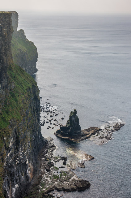
A small stack at the foot of the cliffs.
Cliffs of Moher :: R0492
Billed as Irelands most visited natural attraction, the Cliffs of Moher are a 5 mile stretch of almost sheer cliffs consisting of bands of sandstone, siltstone, mudstone and shale rising to a maximum height of over 700 feet. They take their name from a former fort called Moher (or Mhothair) which stood on the Hags Head, at the southern end of the line of cliffs, but which was demolished in 1808, during the Napoleonic Wars, to be replaced by the signal tower that now stands there. Near the highest point stands OBriens Tower, built in 1835 by Cornelius OBrien as a viewing point for tourists.
Loading map... (JavaScript required)
- Grid Square
- R0391, 53 images (more nearby 🔍)
- Photographer
- Ian Capper (more nearby)
- Date Taken
- Thursday, 11 September, 2014 (more nearby)
- Submitted
- Saturday, 29 November, 2014
- Subject Location
-
Irish:
 R 032 910 [100m precision]
WGS84: 52:57.7129N 9:26.4464W - Camera Location
-
Irish: R 034 911
- View Direction
- West-southwest (about 247 degrees)