2014
NZ1144 : Line of trees in valley of River Browney
taken 9 years ago, near to Butsfield, County Durham, England
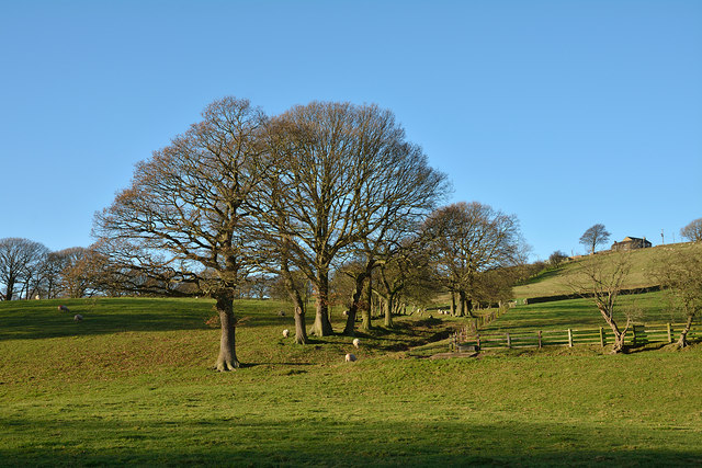
Line of trees in valley of River Browney
The trees rise in a line to the north-west; perhaps they were once part of a hedge and became out of control, growing then to full size.
 Map © Crown Copyright")
TIP: Click the map for more Large scale mapping
- Grid Square
- NZ1144, 7 images (more nearby 🔍)
- Photographer
- Trevor Littlewood (more nearby)
- Date Taken
- Tuesday, 2 December, 2014 (more nearby)
- Submitted
- Tuesday, 2 December, 2014
- Subject Location
-
OSGB36:
 NZ 1157 4489 [10m precision]
WGS84: 54:47.9256N 1:49.2935W - Camera Location
-
OSGB36: NZ 1164 4483
- View Direction
- Northwest (about 315 degrees)