2014
SD5428 : The Old Tram Road
taken 9 years ago, near to Preston, Lancashire, England
This is 1 of 2 images, with title The Old Tram Road in this square
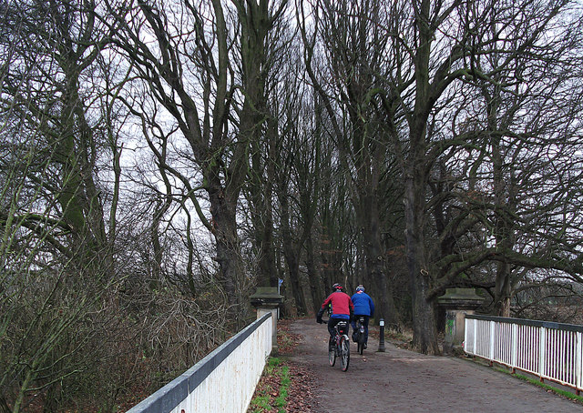
The Old Tram Road
Having just crossed the River Ribble the Old Tram Road forms part of Sustrans NCN route no.55. The original tramway was used to transport goods from the Lancaster canal at Walton Summit to boats on the Ribble at Frenchwood.
 Map © Crown Copyright")
TIP: Click the map for more Large scale mapping
- Grid Square
- SD5428, 118 images (more nearby 🔍)
- Photographer
- michael ely (more nearby)
- Date Taken
- Thursday, 4 December, 2014 (more nearby)
- Submitted
- Friday, 5 December, 2014
- Subject Location
-
OSGB36:
 SD 5417 2857 [10m precision]
WGS84: 53:45.0882N 2:41.7898W - Camera Location
-
OSGB36: SD 5417 2859
- View Direction
- SOUTH (about 180 degrees)