2014
SU6665 : Footbridge over Lockram Brook
taken 9 years ago, near to Burghfield Common, West Berkshire, England
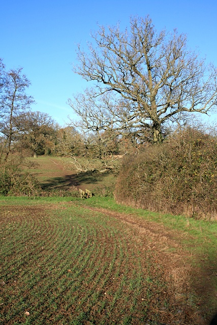
Footbridge over Lockram Brook
Public footpath STRA/22/1 descends to the footbridge over the Lockram Brook, before continuing along the line of an old hedge (still marked by a handful of field trees) towards Lockram Lane. The footpath formerly followed a cross-field alignment further west, but was diverted to this headland route some years ago. It's regrettable that the hedge beyond the brook was nonetheless subsequently removed, despite marking the parish boundary.
 Map © Crown Copyright")
TIP: Click the map for more Large scale mapping
- Grid Square
- SU6665, 49 images (more nearby 🔍)
- Photographer
- Hugh Craddock (more nearby)
- Date Taken
- Saturday, 6 December, 2014 (more nearby)
- Submitted
- Saturday, 6 December, 2014
- Subject Location
-
OSGB36:
 SU 6644 6590 [10m precision]
WGS84: 51:23.2958N 1:2.7940W - Camera Location
-
OSGB36: SU 6646 6585
- View Direction
- North-northwest (about 337 degrees)